



Complete Geography Guide to Murchison Falls National Park
To understand Murchison Falls, you have to read the land itself. Every giraffe silhouetted on a ridge, every crocodile basking on a sandbank, and every thundering column of spray at the falls is a direct product of the park’s physical geography — its rift valley origins, its great river, and the way water and rock have shaped the plains over millennia.
This guide walks through the physical geography of Uganda’s largest national park: where it sits, how big it is, the river that splits it in two, its altitude and vegetation zones, its climate and geology, and — crucially for visitors — how all of that dictates where you find the wildlife.
Location and Size
Murchison Falls National Park sprawls across roughly 3,840 square kilometres of north-western Uganda, making it comfortably the country’s largest protected area. First gazetted as a game reserve in 1926 and upgraded to a national park in 1952, it forms the core of the wider Murchison Falls Conservation Area, which together with the contiguous Bugungu and Karuma wildlife reserves covers more than 5,000 square kilometres.
The park straddles four districts — Kiryandongo, Nwoya, Buliisa and Masindi — spreading inland from the eastern shore of Lake Albert. Its sheer scale is part of the appeal: you can drive for hours across open country and rarely see another vehicle, a rarity in East Africa’s better-known reserves.
The Victoria Nile: The Park’s Defining Feature
No single feature shapes the park more than the Victoria Nile. The river enters from the east near Karuma and slices the park almost exactly in two, running east to west for around 115 kilometres before emptying into Lake Albert. This division creates the northern and southern banks that organise everything from vegetation to game-drive circuits.
The falls themselves are a masterclass in geology under pressure. After descending a series of rapids, the entire Nile is forced through a rocky cleft only about 7 metres wide, then plunges roughly 43 metres into the churning pool below, known as the Devil’s Cauldron. The volume squeezed through that gap makes it one of the most powerful waterfalls on Earth — the ground genuinely trembles beneath your feet.
Below the falls the river’s energy is spent. The torrent softens into a broad, placid channel that drifts across the rift floor towards the lake, and it is along this calm stretch that the famous boat cruises operate. See our guide to the bottom of the falls boat cruise for how best to experience it.
Lake Albert, the Delta and the Albert Nile
Where the Victoria Nile meets Lake Albert at the park’s western edge, it fans out into a papyrus-choked delta — a maze of channels, marshes and lagoons that is one of the richest birding areas in Uganda. Lake Albert itself is a huge rift lake, roughly 160 kilometres long, shared between Uganda and the Democratic Republic of Congo.
Water leaving the northern tip of the lake continues onward as the Albert Nile, flowing north towards South Sudan. This hydrological hinge — one river feeding a lake and another draining it — makes the delta a natural crossroads for aquatic wildlife, from shoebills to enormous Nile crocodiles. Birders should read our notes on the birds of the Victoria Nile.
Altitude, Rift Valley and Geology
The park sits at the northern end of the Albertine Rift Valley, the western arm of the East African Rift. Its altitude ranges from around 619 metres at the delta on Lake Albert to roughly 1,292 metres at Rabongo Hill in the south — a spread that, combined with the terrain, produces subtle but real variations in climate and habitat.
The dramatic backdrop to the south is the Bunyoro escarpment, the ancient rift cliff that tumbles down onto the savanna plains. It was these same remnant rift-valley rocks that pinched the Nile into the narrow gorge at the falls. The underlying geology is largely Precambrian basement rock, overlain by the fertile sediments that feed the grasslands and support the park’s grazing herds.
Vegetation Zones
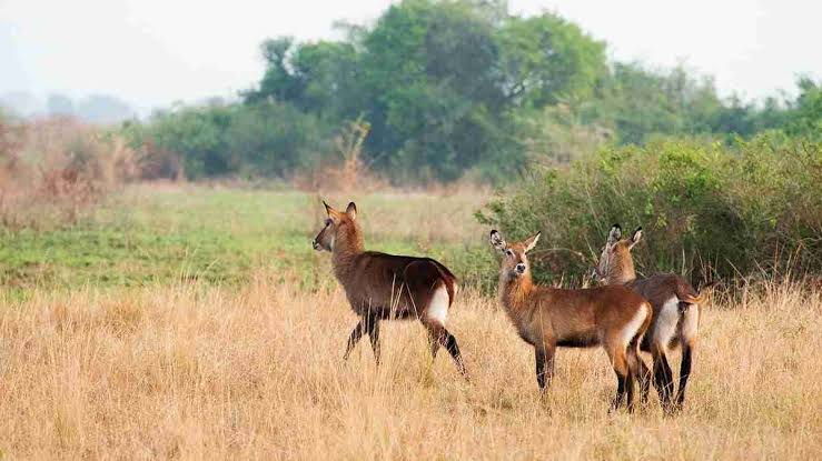
The river neatly separates two very different worlds. North of the Nile lies classic savanna grassland, dotted with tall borassus palms, acacia trees and riverine woodland — open, rolling country that carries the bulk of the park’s large mammals.
South of the river the landscape closes in, giving way to woodland, dense thickets and tropical forest. The largest of these is Budongo Forest, a mahogany-rich block of some 435 square kilometres on the escarpment that shelters chimpanzees and a wealth of forest birds. The delta adds a third zone of papyrus swamp and marshland, so within a single day you can pass through three distinct ecosystems.
Climate
Sitting close to the equator, the park has a warm, fairly uniform tropical climate. Daytime temperatures hover around 31°C, cooling to about 18°C at night, and mean annual rainfall is roughly 1,085 mm — modest by Ugandan standards.
Rain falls mainly in two wetter spells, broadly March to May and August to November, with drier, dustier conditions between. Lake Albert and the forests moderate local conditions, and the higher southern ground runs a touch cooler than the baking northern plains.
How Geography Shapes the Wildlife
For visitors, geography is destiny. The open northern savanna is where you’ll find the great herds — elephant, buffalo, Uganda kob, Jackson’s hartebeest and the park’s celebrated Rothschild’s giraffe — drawn to the grasses and the river’s edge. This is why the Buligi game-drive circuit on the northern bank is the classic route for big-game sightings.
South of the river, the forested terrain favours primates and shy woodland species, which is where chimpanzee trekking in Budongo Forest comes into its own. The Nile itself concentrates hippos, crocodiles and waterbirds along its banks, while the delta rewards patient birders. Understanding these zones is the key to planning where and when to go.
Frequently Asked Questions
- How big is Murchison Falls National Park?
-
It covers about 3,840 square kilometres, making it Uganda’s largest national park. Including the neighbouring Bugungu and Karuma reserves, the greater conservation area exceeds 5,000 square kilometres.
- How high does the water drop at the falls?
-
The Victoria Nile squeezes through a gorge only about 7 metres wide and plunges roughly 43 metres into the Devil’s Cauldron below.
- Which side of the river has the best game viewing?
-
The northern bank, with its open savanna and borassus palms, holds the largest concentrations of elephant, giraffe, buffalo and antelope. The forested south is better for chimpanzees and other primates.
- What is the altitude range of the park?
-
Elevation runs from around 619 metres at the Lake Albert delta up to about 1,292 metres at Rabongo Hill in the south.
Plan Your Safari
Knowing the lie of the land turns a good safari into a great one. Our team builds itineraries around the park’s geography — pairing northern-bank game drives with the boat cruise to the falls and, for those with time, a foray into Budongo Forest. Browse our best Uganda safari packages or get in touch to design a trip that reads the landscape as closely as this guide does.