



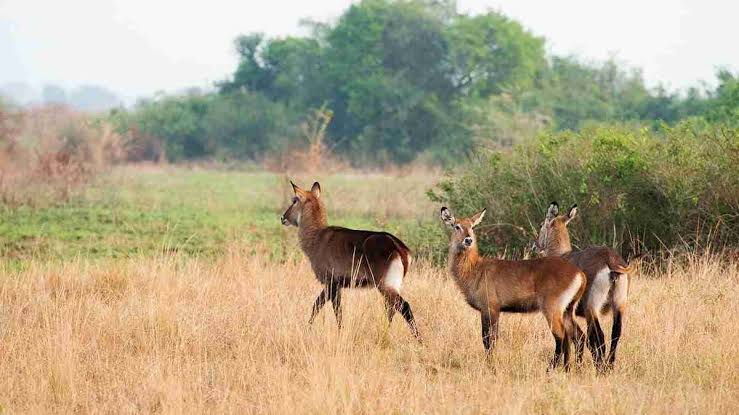
Karuma and Murchison Falls National Park
Every road safari to Murchison Falls from Kampala or Gulu passes through Karuma — where the Victoria Nile roars over granite outcrops and the Kampala–Gulu highway crosses the park’s north-eastern corner. Most travellers treat it as a photo stop. That is a missed opportunity. Karuma marks the eastern boundary of the Murchison Falls Conservation Area, anchors the northern gate network, and sits beside a 675-square-kilometre wildlife reserve that few itineraries mention by name.
This guide explains how Karuma Falls, Karuma Wildlife Reserve and Murchison Falls National Park fit together — distances, gates, bridge logistics and what to expect at the roadside. Pair it with our Kampala to Murchison Falls, Greater Murchison Conservation Area and best route pages when you match your lodge to the road.
Where Karuma Sits in the Murchison Landscape
Murchison Falls National Park covers roughly 3,840 square kilometres — Uganda’s largest protected area. Together with the contiguous Bugungu and Karuma Wildlife Reserves, UWA manages the landscape as the Murchison Falls Conservation Area (MFCA), totalling about 5,072 km². The Victoria Nile runs west from Karuma Falls through savannah and riverine forest to the Albert Delta at Lake Albert — a corridor of more than 100 kilometres inside the system.
Karuma Wildlife Reserve forms the north-eastern buffer, gazetted in 1964 and covering approximately 675 km² in Kiryandongo District. Elephant, buffalo, Rothschild giraffe and antelope use it as a movement corridor between the core park and surrounding landscapes. Standard UWA park entry through official gates covers MFCA as one unit — no separate permit is needed when entering via Chobe, Wankwar or Tangi.
Karuma Falls: The Nile’s Eastern Gateway
Karuma Falls lies where the Masindi–Gulu road crosses the Victoria Nile — roughly 260 kilometres north of Kampala, about 110 kilometres north-east of Masindi and 70 kilometres south of Gulu. The falls are not as dramatic as Murchison Falls itself, where the Nile forces through a six-metre gorge and drops roughly 45 metres, but the river churns impressively over scattered granite rocks, sending white spray northward.
Local legend attributes the stone arrangement to Karuma, a spirit said to have placed the boulders that break the current. Olive baboons, vervet monkeys and black-and-white colobus line the road margins — often visible before you reach the bridge. Pied kingfishers, herons and hornbills work the shallows. During dry spells, elephant sometimes appear near the river corridor as they track water between the reserve and the northern park sector.
Karuma Bridge and the Northern Gate Network
Karuma Bridge, built in 1963 to serve cotton farmers in the West Nile region, spans the falls on the Kampala–Gulu–Pakwach highway — the only fixed Nile crossing between Jinja and Lake Albert. Three UWA gates open off this corridor. Chobe Gate sits two to three kilometres north of the bridge. Wankwar Gate, south of Purongo, and Tangi Gate, near Pakwach about 25 kilometres from Paraa, put you directly onto the Buligi savannah without crossing the Paraa ferry — the main reason north-bank lodges favour this approach over Masindi–Kichumbanyobo.
From Kampala to Karuma, allow roughly four to five hours on tarmac. From Karuma to Tangi Gate is a further 30 to 45 minutes. Refuel before you enter — pumps at Karuma can be unreliable. Our fuel stations guide lists dependable fill-up points on the northern corridor.
Bridge Closures and the New Karuma Bridge
Structural cracks forced a full bridge closure from September 2024, diverting all traffic through the park on a designated Tangi–Bugungu transit corridor. UWA enforced a 40 km/h limit, banned stopping and hooting (fine UGX 100,000), and charged US$150 per person for unauthorised route deviations. The bridge reopened to light vehicles on 20 December 2024, with further rehabilitation completed by April 2025. Check Ministry of Works advisories before travel — further closure windows remain possible.
Uganda’s 600-megawatt Karuma Hydroelectric Power Station, commissioned in 2023, sits within the reserve under NEMA guidelines. A completely new bridge is scheduled to begin construction in June 2026, funded by a Japanese JICA grant of roughly UGX 121 billion. The 240-metre extradosed structure will sit about 12 metres above the current deck, with realigned access roads to eliminate sharp curves. Until then, the rehabilitated 1963 bridge carries traffic — plan extra time when lorries queue.
What to Do at Karuma and Sample Itineraries
Karuma works best as a brief stop. The bridge offers the clearest falls view — pull off only where shoulders allow and do not feed the baboons. Decide your gate before leaving Kampala or Gulu: Chobe for lodges near the bridge, Tangi for Buligi and Pakuba game circuits, or cross via Paraa if your lodge sits south of the Nile. See our northern sector guide for track detail.
Two-night north-bank safari: Drive to Karuma, enter Chobe Gate, afternoon Buligi game drive, overnight at a north-bank lodge. Day two — dawn drive, Paraa launch cruise (UWA fee US$30), optional Top of the Falls hike (US$15 with a ranger). Gulu–Murchison–Kidepo circuit: Enter Tangi from Gulu, overnight at Pakuba or Chobe, then continue toward Kidepo Valley National Park. Our Gulu and Murchison Falls guide covers Acholi cultural stops en route.
Practical Details: Fees, Gates and Timing
Foreign non-residents pay US$45 per adult per 24 hours under the July 2024–June 2026 UWA tariff; children aged 5–15 pay US$25. Gates open at 07:00 and close at 19:00. The Paraa ferry runs hourly from 07:00 to 19:00 with no 13:00 sailing — missing the last crossing strands you on the wrong bank.
The northern sector holds Murchison’s densest game — Rothschild giraffe, elephant, buffalo, lion and leopard on the Buligi, Pakuba and Victoria tracks. The Pakuba track connects Buligi to Tangi in about 17 kilometres. For chimp trekking at Kaniyo Pabidi in Budongo, the Masindi–Kichumbanyobo route remains simpler despite the longer drive.
Frequently Asked Questions
- Is Karuma Falls inside Murchison Falls National Park?
-
Karuma Falls sits on the eastern boundary of the Murchison Falls Conservation Area, within Karuma Wildlife Reserve. UWA manages reserve and park as one protected system. You pass through reserve land before reaching Chobe or Wankwar gates.
- How far is Karuma from Kampala and Gulu?
-
Karuma lies roughly 260 kilometres north of Kampala — typically four to five hours — and about 70 kilometres south of Gulu, roughly one hour by road.
- Which gate should I use after crossing Karuma Bridge?
-
Chobe Gate suits lodges near the bridge. Tangi Gate, near Pakwach, opens onto the Buligi Peninsula — the default for most northern game drives. Wankwar Gate, south of Purongo, suits itineraries from the Gulu direction.
- Can I stop on Karuma Bridge to photograph the falls?
-
Brief stops are possible on road shoulders, but traffic is heavy and baboons approach vehicles. During transit diversions, stopping inside the park is prohibited except at designated points.
- Will the new Karuma Bridge affect safari access?
-
Construction begins in June 2026 and may cause periodic traffic management, but the existing bridge remains open during preparatory works. Any full closure would likely repeat the 2024 Tangi–Bugungu transit arrangement.
Plan Your Safari
Karuma is the eastern door to Uganda’s largest conservation landscape — falls, baboons and a northern gate network that puts you among elephant and giraffe within an hour of the highway. Browse our Murchison Falls safari packages and travel guide, and tell us whether you are arriving from Kampala, Gulu or Kidepo — we will match the gate, drive times and lodge to the Karuma corridor that suits your route.