



Karuma Falls Guide
Long before you reach Paraa or the thunder of Murchison Falls itself, the Victoria Nile announces itself at Karuma — a long run of white water where granite ledges split the river into roaring channels. Most safari travellers pass through without stopping, yet Karuma is one of northern Uganda’s defining landmarks: a natural cataract, a historic bridge crossing and, since 2024, the site of the country’s largest hydropower plant.
This guide covers what Karuma Falls is, where it sits in relation to Murchison Falls National Park, how to reach it and what to expect when you cross the Nile on the Kampala–Gulu Highway. Whether you are heading to Chobe Gate, continuing to Gulu and Kidepo, or planning the northern approach to the park, Karuma is worth understanding in detail.
Where Karuma Falls sits on the map
Karuma Falls lies on the Victoria Nile at the eastern edge of the Murchison Falls Conservation Area, where the river accelerates over rock outcrops before reaching Murchison Falls roughly 80 kilometres downstream. The falls mark the spot where the Kampala–Gulu Highway (A104) crosses the Nile.
The site straddles Kiryandongo and Oyam districts, beside the Karuma Wildlife Reserve — gazetted in 1964 and covering roughly 675 square kilometres — which buffers elephant, buffalo and Rothschild’s giraffe moving between the park and the highway. From Kampala, Karuma Bridge sits about 257 to 270 kilometres north on tarmac. Masindi lies roughly 110 kilometres south-west; Gulu is about 70 to 77 kilometres north. See our district guide for the wider geography.
The falls: geology, legend and the Nile
Unlike the single plunge at Murchison Falls, Karuma is a series of rapids — the Nile forced through natural rock formations over several kilometres. Below the bridge, turbulent ledges and channels continue for roughly 23 kilometres before the current eases. Local Acholi tradition holds that a spirit named Karuma placed the stones that break the water, giving the falls their name.
John Hanning Speke passed this stretch during his 1860s Nile expeditions, and the crossing has mattered ever since — first by ferry, then by the permanent bridge that transformed trade with West Nile and South Sudan. The effect is less a postcard waterfall and more a sustained, thunderous cataract on one of the world’s longest river systems.
Karuma Bridge and the hydropower project
The original Karuma Bridge, completed in 1963, carries the highway directly over the rapids and remains the familiar landmark for most travellers. From the deck you get the clearest view of the falls — the Nile churning below, spray rising from the channels, heavy lorries rumbling past on one of East Africa’s busiest trade corridors.
Adjacent to the historic crossing, the Karuma Hydropower Station — a 600-megawatt plant commissioned in September 2024 — is Uganda’s largest power installation, with six 100-megawatt turbine units. A new cable-stayed bridge is under development alongside it. Confirm current crossing arrangements before travel.
Wildlife at Karuma and the wildlife reserve
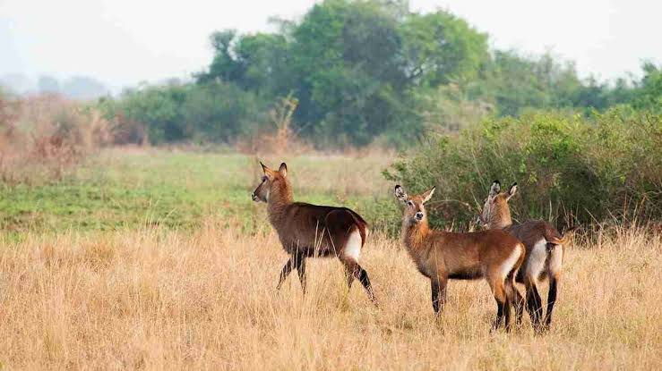
Olive baboons congregate at the bridge and roadside pull-offs. Beyond the tarmac, the reserve holds elephant, buffalo, Uganda kob, waterbuck and Rothschild’s giraffe, with fish eagles and kingfishers along the rapids. The reserve is an elephant movement corridor — stopping randomly on verge tracks is discouraged. Continue north to Chobe Gate and the Chobe sector for boat trips and game drives.
Getting to Karuma Falls
From Kampala, follow the Gulu Highway through Luweero, Nakasongola and the Kafu River bridge. Most organised transfers allow four to five hours to Karuma with stops; heavy truck traffic can push the run toward six hours. Daily buses between Kampala and Gulu pass through Karuma trading centre, though you still need private transport to reach park gates beyond the bridge.
From Gulu, allow one to one-and-a-half hours south. From Masindi, roughly two hours north-east. Many itineraries break the journey at Ziwa Rhino Sanctuary near Nakitoma for on-foot rhino tracking before continuing north. Our Kampala to Murchison Falls and Gulu and Murchison Falls guides cover timing in full.
Karuma as the gateway to northern Murchison
For travellers bound for north-bank lodges — Pakuba, Chobe Safari Lodge, Nile Safari Lodge — or onward to Kidepo Valley National Park, Karuma is the pivot point. Chobe Gate sits two to three kilometres north of the bridge; Tangi Gate near Pakwach opens the north-western savannah roughly 25 kilometres from Paraa. Both put you on northern game tracks without an immediate Paraa ferry crossing.
If your lodge sits south of the Nile, the Masindi route through Kichumbanyobo Gate is usually simpler despite the ferry wait. See our best route comparison to match gate to lodge.
What to do at Karuma Falls
Most visitors experience Karuma from the bridge — a brief pause to photograph the rapids and watch baboons along the roadside. There is no visitor centre or formal viewing platform; the falls are part of a working highway, not a ticketed attraction. Those staying at Chobe Safari Lodge gain a slower perspective — terraces overlooking the rapids, boat trips and world-class Nile perch sport fishing below Karuma on a catch-and-release basis with UWA permits. Even a 20-minute bridge stop gives context for the river you will cruise beside for the rest of your safari.
Practical tips for travellers
Karuma trading centre sometimes has diesel but petrol is unreliable — fill up in Masindi, Gulu or Pakwach instead. See our fuel stations guide. Keep food out of sight and doors closed at bridge stops; baboons here are habituated and can be aggressive if fed. Pull off only where safe — the highway carries heavy commercial traffic toward South Sudan and West Nile. Viewing the falls from the highway is free; entering Murchison through Chobe, Tangi or Wankwar gates requires a UWA park permit — currently US$45 per adult per 24 hours for foreign non-residents under the July 2024–June 2026 tariff.
Frequently Asked Questions
- How far is Karuma Falls from Kampala?
-
Karuma Bridge lies roughly 257 to 270 kilometres north of Kampala on the Gulu Highway. Allow four to five hours by road with stops, or up to six hours in heavy traffic.
- Is Karuma Falls inside Murchison Falls National Park?
-
The falls sit on the park’s eastern boundary within the wider conservation area, alongside Karuma Wildlife Reserve. The highway bridge is outside any gated sector, but Chobe Gate — a few kilometres north — enters the park proper.
- Can you visit Karuma Falls without entering the park?
-
Yes. The falls are visible from the public highway and bridge. No park ticket is needed to cross or pause at roadside viewpoints.
- What is the difference between Karuma Falls and Murchison Falls?
-
Karuma is a long series of rapids where the Nile crosses the Gulu highway; Murchison Falls, about 80 kilometres downstream, is where the entire river forces through a seven-metre gorge. Both are on the Victoria Nile within the same conservation landscape.
- Is the Karuma Bridge open for safari traffic?
-
The historic Karuma Bridge remains the main Nile crossing on the Kampala–Gulu route. A new bridge is under development — confirm current arrangements with your operator or UWA before travel.
Plan Your Safari
Karuma Falls is the moment the Nile becomes real on your journey north — the gateway to Murchison’s eastern sector and some of Uganda’s finest game country. We build northern-route itineraries that time your Karuma crossing with Chobe or Tangi gate entry, Ziwa rhino tracking and onward links to Kidepo. Browse our Murchison Falls safari packages, read the first-time visitors guide and full Murchison Falls travel guide, or tell us your lodge and start point — we will route you through Karuma with daylight to spare.