



Pakwach District Travel Guide
Pakwach District is where the Albert Nile meets the West Nile road network — a riverside region most safari travellers cross without realising how much history, culture and wildlife sit within its boundaries. The district hosts Uganda’s only permanent bridge over the Albert Nile, the western approach to Murchison Falls National Park through Tangi Gate, and heritage sites tracing Luo origins, Catholic pilgrimage and the colonial scramble for the upper Nile. If your itinerary runs Karuma to Arua, or you enter Murchison from the north-west, you are travelling through Jonam country on one of Uganda’s most strategic safari corridors.
This guide maps Pakwach District as a region: geography, Jonam heritage, colonial Wadelai, natural features and links to Murchison Falls and Ajai Wildlife Reserve. For town-level detail, see our Pakwach town guide; for how the district fits among Murchison’s four host districts, see which districts Murchison spans.
Where Pakwach District sits
Pakwach District lies in Uganda’s West Nile sub-region, with headquarters in Pakwach Town Council on the Albert Nile at roughly 2°27′N, 31°30′E. Created in 2015 and operational from 1 July 2017, it covers 1,008.6 square kilometres and had 206,961 residents in the 2024 census. It borders Nebbi, Arua, Nwoya, Amuru, Buliisa and the DRC across Lake Albert. Pakwach town sits about 20 kilometres east of Nebbi, 131 kilometres south-east of Arua and roughly 370 kilometres — five to six hours — from Kampala via Karuma–Olwiyo–Pakwach. Murchison Falls National Park begins on the opposite bank. See our complete transport guide for gate-by-gate driving detail.
Jonam heritage and sacred sites
The people of Pakwach District are predominantly Jonam — a Luo-speaking community whose name derives from Jo (people) and Nam (river). Jonam trace their origins to the Bar-el Gazel region of South Sudan, migrating southward in the 16th century under chiefdoms governed by a Rwot.
The district’s most revered landmark is Wang-Lei, on the Albert Nile bank immediately downstream of the Pakwach Bridge. Luo oral tradition holds that the brothers Gipir and Labongo parted here after a dispute over a spear and a bead — an event credited with shaping the Alur and Acholi peoples. Every 18 February, descendants gather for the Thumo Wang-Lei reconciliation ritual. A retainer wall completed in 2021 protects the site from rising Nile floods; arrange access through local cultural contacts.
At Omach, the Ganal Pilgrimage Site draws thousands of Catholic faithful each March, commemorating Comboni missionaries welcomed by Chief Omach around 1910 — the first ruler in northern Uganda to receive missionaries.
Colonial history at Wadelai
North of Pakwach town, Wadelai Sub-county holds one of the Albert Nile’s most significant colonial sites. In the 1880s, Emin Pasha established his final chief station here as Mahdist forces closed in. Winston Churchill described Wadelai as “newly abandoned to ruin” after visiting in 1907. Fort Emin Pasha was gazetted in 1972; earthworks lie near the original Nile bank. Wadelai is roughly 30 kilometres north of Pakwach — pair with Ajai Wildlife Reserve and allow a high-clearance vehicle after rain.
Natural features and the Albert Nile
At Panyimur, on the Lake Albert shore, the Amoropii hot springs bubble where the Albert Nile meets the lake — a geothermal feature the Jonam and Alur have long regarded as spiritually significant, within the wider Lake Albert ecosystem. At Owiny Primary School, a monument marks the 2013 hybrid solar eclipse path. From the Pakwach Bridge — the only permanent bridge in Uganda over the Albert Nile, completed in 1965 — views extend toward Murchison’s northern savannah and Tangi Gate.
Wildlife, Tangi Gate and Ajai
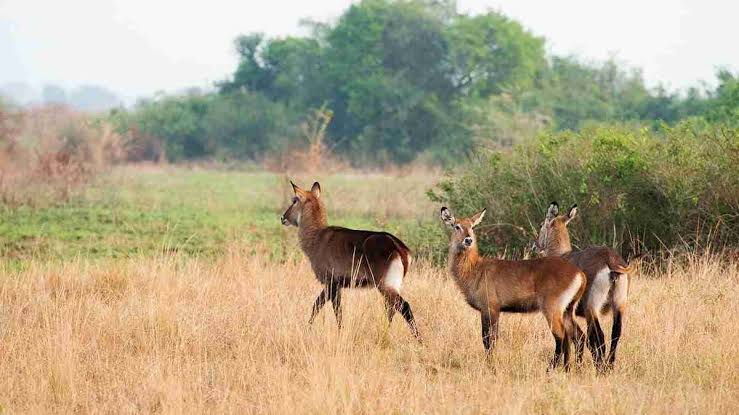
Tangi Gate, UWA’s north-western entrance to Murchison Falls National Park, sits about three kilometres south of Pakwach town on a signposted murram turn-off roughly 700 metres before the Albert Nile Bridge. From Karuma Bridge, allow about 110 kilometres and two to three hours; UWA places Tangi roughly 25 kilometres from Paraa. The gate lands you on the northern savannah — the Buligi game drive circuit and Rothschild’s giraffe plains — without a Paraa ferry on arrival. Foreign non-resident park entry is US$45 per 24 hours (July 2024–June 2026).
West of the Nile, Ajai Wildlife Reserve in neighbouring Madi Okollo District is re-emerging as a conservation story. In January 2026, UWA translocated the first four southern white rhinos from Ziwa Rhino Sanctuary, with plans for 20 across about 166 square kilometres of seasonally flooded grassland. Fly-in guests reach Pakuba Airstrip, roughly 19 kilometres from Paraa.
Getting around and when to visit
The Karuma–Olwiyo–Pakwach–Nebbi–Arua highway skirting Murchison’s northern edge is the district’s spine. Internal tracks need a high-clearance 4×4 in wet months — particularly April and May. Dry seasons from December to February and June to September firm up roads and concentrate wildlife at water. Carry Ugandan shillings and take malaria prophylaxis on the Nile bank.
Across Lake Albert, the Wanseko–Panyimur ferry (MV Albert Nile 1) links Panyimur with Buliisa District. The vessel was suspended for repairs in March 2025; confirm it is running before building it into your route. See our Buliisa District guide and northern Uganda road trip guide for multi-stop routing.
Frequently Asked Questions
- Where is Pakwach District?
-
In Uganda’s West Nile sub-region, with headquarters in Pakwach town on the Albert Nile. It borders Nebbi, Arua, Nwoya, Amuru, Buliisa and the DRC, roughly 370 kilometres north-west of Kampala.
- When was Pakwach District created?
-
Established in 2015 and operational from 1 July 2017, carved from Nebbi District. The 2024 census recorded 206,961 residents.
- What cultural sites should I visit?
-
Wang-Lei — where Gipir and Labongo are said to have parted — is the headline Jonam site, with the Thumo Wang-Lei ceremony each 18 February. The Ganal Catholic pilgrimage at Omach each March and Fort Emin Pasha at Wadelai add further depth.
- How do I reach Murchison Falls from Pakwach?
-
Enter via Tangi Gate, about three kilometres south of town, onto the northern game-drive network toward Buligi and Paraa. Allow a high-clearance 4×4 and arrive before UWA’s afternoon entry cutoff.
- Is Ajai Wildlife Reserve worth visiting?
-
Yes — especially since UWA reintroduced white rhinos in January 2026. Ajai lies west of the Nile along the Pakwach–Wadelai road, roughly 30 to 40 kilometres from town.
Plan Your Safari
Pakwach District rewards travellers who treat the West Nile corridor as more than a transit line — Jonam heritage at Wang-Lei, colonial Wadelai, Amoropii hot springs and Tangi Gate minutes from Rothschild’s giraffe country. Browse our Murchison Falls safari packages, read the first-time visitors guide and full Murchison Falls travel guide, and tell us where you are starting from.